


TopoDroid

وصف لـTopoDroid
TopoDroid - Cave surveying on Android
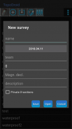
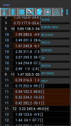
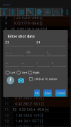
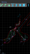
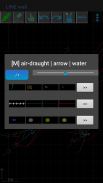
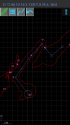
TopoDroid helps you to take survey data and accurate sketches while you are in the cave, so that you can detect errors in the data while you are still on the spot and correct them. TopoDroid has many functions to help you get the most out of a surveying trip. In this way, by the time you finish it, a working map is almost ready.
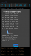
TopoDroid is designed to work *ONLY* with the DistoX (versions 1 and 2), although the survey data can be also entered by hand. TopoDroid has DistoX calibration functions, as well as other advanced DistoX functions.
NOTE. These DistoX are not a Leica products.
TopoDroid handles one survey session at a time. It is not a cave survey project manager. For that purpose there are many good PC programs, and TopoDroid exports survey data in several cave program formats (among them: therion, compass, visualtopo, walls, survex), as well as dxf, csv, kml, trackfile, shapefile. Sketches can be exported as therion, csurvey, dxf, svg, shapefile, and png image.
Full list of features, user manual, and docs on https://sites.google.com/site/speleoapps/home/topodroid
DISCLAIMER
This app is open-source, free and ad-free. It has no warranty. By using it you agree that the author is not responsible for any loss of data you might incur, or damage whatsoever, including damages to DistoX devices.
ANDROID PERMISSIONS
- TopoDroid requires the following permissions: WRITE_EXTERNAL_STORAGE, BLUETOOTH, BLUETOOTH_ADMIN
- Certain functions depend on these permissions:
CAMERA, RECORD_AUDIO, ACCESS_FINE_LOCATION.
- INTERNET permission is necessary to install translations of the user manual.
BETA and OLD APKS
TopoDroid has an open-beta program: opt-in link on the website.
A few apks of old versions are available on the website.
TRANSLATIONS
M. Guerrero (spanish), D. Ros (french), A. Kozhenkov (russian), V. Georgiev (bulgarian), M. Keller (german), F. Toso (italian), H.-J. Luo (chinese), P. Suru (hungarian), R. Severo (potuguese), M. Jurecka (slovak), K. Borgiel (polish), A. Pologea (romanian)
TopoDroid - مسح الكهف على الروبوت
يساعدك TopoDroid على أخذ بيانات المسح والرسومات الدقيقة أثناء وجودك في الكهف ، بحيث يمكنك اكتشاف الأخطاء في البيانات أثناء وجودك في الموقع وتصحيحها. لدى TopoDroid العديد من الوظائف لمساعدتك في الحصول على أقصى استفادة من رحلة المسح. وبهذه الطريقة ، عند الانتهاء من ذلك ، تكون خريطة العمل جاهزة تقريبًا.
تم تصميم TopoDroid للعمل * فقط * مع DistoX (الإصدارات 1 و 2) ، على الرغم من أنه يمكن أيضًا إدخال بيانات المسح باليد. يحتوي TopoDroid على وظائف معايرة DistoX ، بالإضافة إلى وظائف DistoX المتقدمة الأخرى.
ملحوظة. هذه DistoX ليست من منتجات Leica.
TopoDroid يتعامل مع جلسة مسح واحدة في وقت واحد. انها ليست مدير مشروع مسح الكهف. لهذا الغرض ، يوجد العديد من برامج الكمبيوتر الجيدة ، وتقوم TopoDroid بتصدير بيانات المسح في العديد من تنسيقات برامج الكهوف (من بينها: therion ، البوصلة ، visualtopo ، الجدران ، surveyx) ، وكذلك dxf ، csv ، kml ، trackfile ، shapefile. يمكن تصدير الرسومات كصورة therion و csurvey و dxf و svg و shapefile و png.
قائمة كاملة بالميزات ودليل المستخدم والمستندات على https://sites.google.com/site/speleoapps/home/topodroid
تنصل
هذا التطبيق مفتوح المصدر ، مجاني وخالي من الإعلانات. لا يوجد لديه الضمان. باستخدامه ، فإنك توافق على أن المؤلف غير مسؤول عن أي فقد للبيانات قد تتعرض له أو تلفه على الإطلاق ، بما في ذلك الأضرار التي لحقت بأجهزة DistoX.
أذونات الروبوت
- يتطلب TopoDroid الأذونات التالية: WRITE_EXTERNAL_STORAGE و BLUETOOTH و BLUETOOTH_ADMIN
- وظائف معينة تعتمد على هذه الأذونات:
CAMERA ، RECORD_AUDIO ، ACCESS_FINE_LOCATION.
- إذن INTERNET ضروري لتثبيت ترجمات دليل المستخدم.
BETA و APK القديم
لدى TopoDroid برنامج مفتوح التجريبي: رابط التقيد على الموقع.
هناك عدد قليل من تطبيقات الإصدارات القديمة المتوفرة على الموقع.
TRANSLATIONS
M. غيريرو (الأسبانية) ، D. Ros (الفرنسية) ، A. Kozhenkov (الروسية) ، V. Georgiev (البلغارية) ، M. Keller (الألمانية) ، F. Toso (الإيطالية) ، H.-J. لوه (الصينية) ، P. Suru (الهنغارية) ، R. Severo (potuguese) ، M. Jurecka (السلوفاكية) ، K. Borgiel (البولندية) ، A. Pologea (الرومانية)


